Cypress Hills on foot and by paddle: trails, lakes and viewpoints on the Alberta side
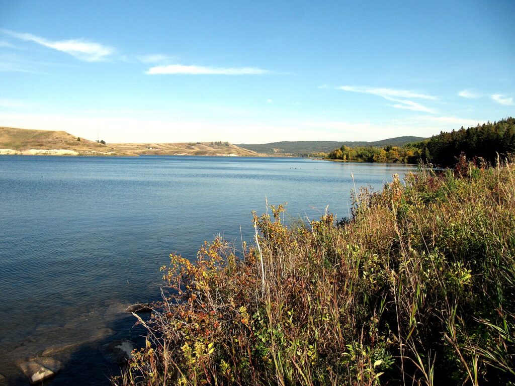
Cypress Hills Interprovincial Park straddles the Alberta and Saskatchewan border. On the Alberta side, Cypress Hills Provincial Park centres on the Elkwater townsite and Elkwater Lake. Tourism Medicine Hat says the hills rise 600 metres above the surrounding prairie of southeastern Alberta. This post covers the trails, lakes, viewpoints and driving routes listed by Alberta Parks and Tourism Medicine Hat, as checked on 16 November 2026.
How high the hills climb
Alberta Parks says the park's trails begin at 1,234 metres above sea level, the same elevation as Banff, and rise 200 metres to the highest point east of the Rockies. Tourism Medicine Hat describes the Cypress Hills as rising 600 metres above the surrounding prairie. The park has more than 50 kilometres of hiking trails, ranging from natural surfaces to paved paths and boardwalk, and over 60 kilometres of trails used for mountain biking. Alberta Parks offers a summer trails guide with maps, which is also available at the Visitor Centre. Report downed trees or other hazards to the Visitor Centre. Alberta Parks says the mountain biking season runs from April to October, depending on weather, and bike rentals open during peak season in the Elkwater Lake area.
Trails near Elkwater for an easy start
Tourism Medicine Hat lists the Lakeview Trail as a flat, paved path with a view of Elkwater Lake and the only wheelchair-friendly trail in Elkwater. The Firerock Trails, near Firerock Campground, run through forested rolling hills and are described as family friendly. Both suit a first afternoon after the drive in. Alberta Parks lists several trails for both hiking and biking. Tourism Medicine Hat suggests carrying plenty of water, bug spray and bear spray; it says there are no bears in the area but calls bear spray good hiking practice. Check the park's advisories page before you set out, since trail work and seasonal service changes are posted there.
Horseshoe Canyon and longer routes
Alberta Parks lists Horseshoe Canyon trail at 4 kilometres with 241 metres of elevation and an intermediate rating. It starts at the roadway into Old Baldy Campground and climbs an old road through fields and mixed forest to a view of the Horseshoe Canyon landslide and rangeland to the north; from the top it links with Beaver Creek Trail. Tourism Medicine Hat suggests allowing 2 to 3 hours with a family. For a full day, the Spruce Coulee trail system runs about 25 kilometres one way from Reesor Lake Viewpoint to Battle Creek Campground. The Mystery Trail is a longer climb close to the townsite, and Tourism Medicine Hat suggests reaching the Beaver Creek viewpoint and looping down on Horseshoe Canyon Trail.
Three lakes, three sets of boat rules
Alberta Parks describes Elkwater Lake as the largest body of water in the park, 4 kilometres long and 3 kilometres wide with a maximum depth of 10 metres; all boat types are allowed. Its beach areas at Main Beach and West End Day Use are unsupervised. Reesor Lake, 20 kilometres east of Elkwater, allows only non-motorized boats and electric motors, and Alberta Parks posted a blue-green algae advisory there in August 2026. Spruce Coulee Reservoir, 14 kilometres east, allows only non-motorized boats, and Tourism Medicine Hat does not recommend swimming there. The same source says paddling rentals are available at the Cypress Hills Visitor Centre. For anglers, Alberta Parks says Elkwater Lake has naturally occurring perch and pike, Reesor Lake and Spruce Coulee Reservoir are stocked each year, and park staff cannot issue fishing licences.
Viewpoints by car
Alberta Parks describes two driving routes. On the west route, Head of the Mountain viewpoint marks the highest point in the Cypress Hills, and Horseshoe Canyon Viewpoint looks over the countryside to the north and northwest. The east route is a 60-kilometre loop past Reesor Viewpoint, and you can continue to Fort Walsh National Historic Site on the Saskatchewan side. Road conditions decide which routes are open, and some roads close after heavy rain or slumping, so check with the Visitor Centre first. Off-highway vehicles, including snowmobiles and dirt bikes, are not allowed in the park. Alberta Parks also lists golf at Elkwater Park Golf Club, plus mini golf and disc golf, among the park's summer activities.
The short version
- Trails start at 1,234 m and rise 200 m to the highest point east of the Rockies, per Alberta Parks.
- Lakeview Trail is the paved, wheelchair-friendly option in Elkwater.
- Horseshoe Canyon trail is 4 km with 241 m of elevation, rated intermediate.
- Elkwater Lake allows all boats; Reesor Lake and Spruce Coulee are quieter, with stricter boat rules.
- Check the Visitor Centre for road conditions before the driving loops.
Cypress Hills questions
Which Cypress Hills trail works with a wheelchair or stroller?
Tourism Medicine Hat lists the paved, flat Lakeview Trail as the only wheelchair-friendly trail in Elkwater.
Can I rent a canoe or paddleboard in the park?
Tourism Medicine Hat says paddling rentals are available at the Cypress Hills Visitor Centre.
Are dirt bikes or snowmobiles allowed?
No. Alberta Parks says off-highway vehicles are not allowed in the park.
Where can I book a hotel near Cypress Hills?
The closest city on our list is Medicine Hat. Prairie Crest Medicine Hat and Ramada by Wyndham Medicine Hat are both on Orbitz; check distances and rates there.
Sponsored guide. bipaventures.com earns a commission when you book through links on this page, and that affects which hotels we feature and in what order. We do not take bookings. Destination details come from tourism board, park and attraction websites as of 16 November 2026; confirm current rates, fees and cancellation terms on the booking site before you pay.
Operated through bipaventures.com.
Not affiliated with or endorsed by Alberta Parks, Tourism Medicine Hat or the hotels named. Hotel and brand names are used only to identify them.